- Shortcut Menu
- Body Shortcut
- Main Menu Shortcut
GEO works across 8 Societal Benefit Areas to translate Earth Observations into support for decision-making.
Biodiversity & Ecosystem Sustainability
TOP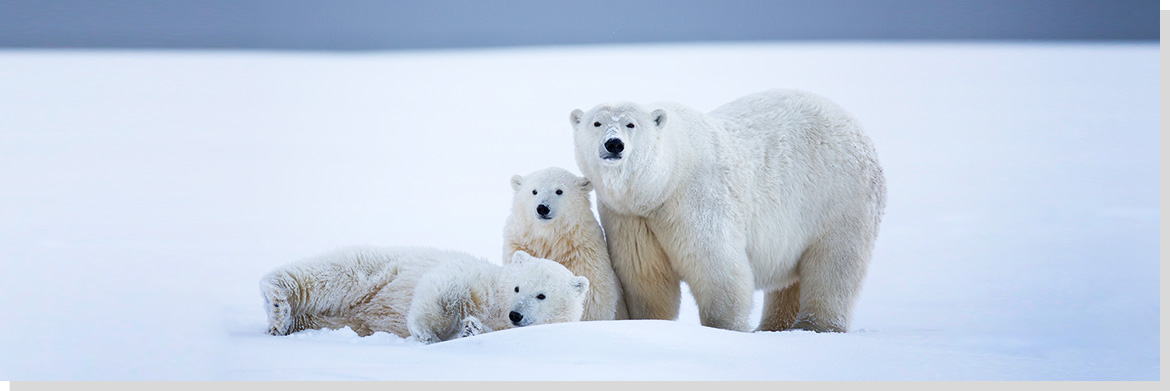
Scientists study living creatures from microbes to whales, from insects to polar bears, from algae to rainforests. GEOSS is linking together the world’s many stand-alone biodiversity monitoring systems and connecting them to other Earth observation networks that generate relevant data, such as climate and pollution indicators.
Data sets about plants and animals on the GEOSS portal comply with global standards so it is possible to identify gaps in taxonomic and biological information, generate updated assessments of global biodiversity trends, track the spread and retreat of invasive alien species, and monitor how biodiversity responds to climate change.
Biodiversity Observation Network
TOPThe Group on Earth Observations Biodiversity Observation Network - GEO BON - coordinates data on biological diversity, encompassing all of the Earth’s plants, animals and micro-organisms. GEO BON is working to improve the quality and quantity of biodiversity information and analysis for the conservation and sustainable use of the world’s biological resources.
Around 100 governmental, inter-governmental and non-governmental organizations are collaborating through GEO BON to organize and improve terrestrial, freshwater and marine biodiversity observations globally and make their biodiversity data, information and forecasts more readily accessible to policymakers, managers, experts and other users.
GEO BON has been recognized by the Parties to the Convention on Biological Diversity. More information can be found on the GEO BON web pages.
GEO Ecosystems Initiatives
TOPForests, wetlands, and other ecosystems the world over are under tremendous stress from rapid land-use change, pollution and the over exploitation of natural resources. Gaps and weaknesses in monitoring systems make it difficult to manage and protect the environment. GEOSS integrates a wide variety of ecosystem data. This enables researchers to classify ecosystems more accurately so that policy makers act on better information.
The Global Forest Observation Initiative - GFOI - fosters the sustained availability of observations for national forest monitoring systems. Forests absorb carbon dioxide, the main driver of climate change. GFOI supports countries in the development of national systems for forest carbon tracking.
The Global Ecosystem Initiative – GECO - takes a big picture, or macroecology, approach and combines observations and models to focus on ecosystem state, function, processes, and services and the relation to environmental factors.
The GEO Global Network for Observation and Information in Mountain Environments – GEO GNOME - is establishing a global data and information network for mountain regions. It will gather and distribute information on future climate and its impact on mountain regions, build capacity, disseminate knowledge, and build connections between mountain stakeholders and the scientific community.
The GEO Biodiversity and Ecosystem Sustainability community is also work on a range of topics including Natural Capital and Ecosystems Accounting, a global monitoring system for mangroves, an early warning system for Harmful Algal Blooms, and a soils map for Africa.
Disaster Risk Reduction
TOP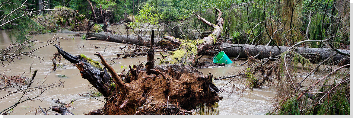
Earth observations contribute to disaster mapping and better mitigation and response, working with the Sendai Framework for Disaster Risk Reduction.
GEO supports disaster resilience by increasing coordination of Earth observations to forecast and prepare for disasters, to mitigate damage and to better manage and recover from disasters.
A substantial reduction of losses of life and property can be achieved by strengthening cooperation and data sharing for satellite and surface data, for managing risks posed by fires, floods, earthquakes and other hazards. Better information, made widely accessible, leads to improved understanding of disaster risk.
The 2015 Sendai Framework for Disaster Risk Reduction recognizes that Earth observations have a clear role in Disaster Risk Reduction. GEO and other partners proposed to establish a Synergy Framework for the Integration of Earth Observation Technologies into Disaster Risk Reduction.
The GEO initiative on Data Access for Risk Management - GEO-DARMA - supports the implementation of the Sendai framework 2016-2030, the first of the post-2015 global agreements to be adopted.
Energy and Mineral Resources Management
TOPFossil fuel energy use accounts for more than two thirds of greenhouse gas emissions. Earth observations can be used to increase the global share of renewable energy sources such as solar and wind power, in combination with energy efficiency, to help limit a further rise in global temperature, in line with The Paris Agreement.
GEO will advocate the value of Earth observations, engage communities and deliver data and information in support of Energy and Mineral Resources Management by enhancing the discovery, development and sustainable production of mineral and renewable energy resources; in order to facilitate substantial increases in the share of renewable energy in the global energy mix, through usable, actionable information on resource assessment, monitoring and forecasting of intermittent energy sources, including solar, wind, ocean, hydropower, geo-thermal power and biomass.
About Energy
TOPExploiting the full potential of energy resources is of critical importance to all countries. This trillion-dollar economic sector includes coal, oil and gas as well as renewable energy sources such as solar, wind and hydropower.
Key concerns for both governments and the private sector include reliable access to energy, the efficient management of energy resources, improved technologies for stabilizing or reducing greenhouse gas emissions, and the need to report energy emissions levels to the UN Climate Change Convention and other bodies.
The Global Earth Observation System of Systems is helping governments and companies to manage energy resources more effectively. GEOSS provides the information they need for evaluating the potential for producing renewable energy and assessing the risks and potential of carbon capture and storage systems designed to reduce greenhouse gas emissions.
GEOSS also provides data and information for monitoring and forecasting fluctuations in hydropower, solar, ocean and wind energy sources; assessing and predicting the environmental impacts of energy exploration, extraction, transportation and consumption; reducing weather-related and other risks to energy infrastructure; matching energy supply and demand; and informing other aspects of energy-policy planning in both developing and developed countries.
Food Security and Sustainable Agriculture
TOPEarth observations combined with other data contribute to crop monitoring to counter food insecurity, a commitment upheld by all states under Sustainable Development Goal 2, zero hunger.
GEO will advocate the value of Earth observations, engage communities and deliver data and information in support of Food Security and Sustainable Agriculture by underpinning development, management and forecasting of global food and agricultural production on land and in the water; in order to end hunger, achieve food security (including monitoring for quality, safety and correct identification) and promote sustainable agriculture adapted to climate change impacts through strengthening food production monitoring and early warning systems, and providing accurate, timely information on agricultural production status, outlook and forecasts.
Earth observations for Agriculture
TOPFood supplies depend on trends in the natural environment, including weather and climate, freshwater supplies, soil moisture and other variables.
At the same time, agriculture has a major impact on the environment. Unless they are sustainably managed, farms and pastures can cause erosion, desertification, chemicals pollution and water shortages. Similarly, fishing can deplete fish stocks and damage coastal ecosystems. These risks need to be monitored and managed.
The Group on Earth Observations is constructing the Global Earth Observation System of Systems to help farmers, fishers and policymakers maximize productivity and food security while preserving ecosystems and biodiversity.
GEO also aims to support the sustainable management of agriculture by disseminating weather forecasts, early warnings of storms and other extreme events, water pollution, long-term forecasts of likely climate change impacts, and information on water supplies.
These and other data are being integrated so that they can be used in models for simulating and predicting agricultural trends. Related activities include mapping the changing distribution of croplands around the world, advancing the accuracy of measurements of biomass (the total amount of living material in a given habitat or population), reporting agricultural statistics in a more timely manner, and improving forecasts of shortfalls in crop production and food supplies.
Public Health Surveillance
TOPPublic health alerts on air quality, outbreaks of disease carried by water-borne vectors, and assessments of access to health facilities are informed by Earth observations and help to achieve SDG Goal 3 on Good Health and Wellbeing.
GEO will advocate the value of Earth observations, engage communities and deliver data and information in support of Public Health Surveillance by yielding insight into the threat of vector-borne and environmentally-linked diseases, taking into account impacts of climate change; in order to promote a substantial reduction in the number of fatalities and illnesses from infectious diseases, environmental pollution and health risks, through raising public awareness and supporting policy making and management with accurate monitoring and early warning at local, national, regional and global levels.
About Health
TOP-
Changes in the natural environment can compromise human health. Droughts may lead to malnutrition and life-threatening forest fires. Dust storms and smog often cause respiratory illnesses. Algal blooms contaminate seafood. Climate change and extreme weather events are associated with a wide range of health risks. Emerging infectious diseases such as HIV/AIDS and Lyme appear to be linked to land-use changes that have opened up previously hidden pathways for disease transmission.
-
The Group on Earth Observations is working with the Health community to improve the flow of user-friendly environmental data. Comprehensive data sets support prevention, early warning, research, health-care planning and delivery, and timely public alerts.
-
Gathered and distributed through the Global Earth Observation System of Systems, these Earth observation data contribute to improving our understanding of how the environment affects human health and well-being. Key variables include airborne, marine, and water pollutants; stratospheric ozone depletion; land-use change; persistent organic pollutants; food security and nutrition; noise levels; weather-related stresses and disease vectors; and many others.
-
For example, remote-sensing observations of weather, land and ocean parameters can now be used to predict outbreaks or trends in infectious diseases such as meningitis, malaria and cholera. Such data need to be readily available to public health workers in a format that they can use.
Infrastructure and Transportation Management
TOPEquitable access to Earth’s resources and proximity of communities to national services can be assessed using Earth observations to meet and measure SDG Goal 9, Build resilient infrastructure, promote sustainable industrialization and foster innovation.
GEO will advocate the value of Earth observations, engage communities and deliver data and information in support of Infrastructure and Transportation Management by providing support for planning, monitoring and management of infrastructure (dams, roads, rail, ports, and pipelines) and transportation (air, land and sea); in order to minimize environmental impacts while moving towards a low-carbon footprint.
Sustainable Urban Development
TOP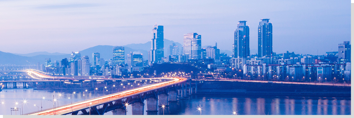
Use of Earth observations can promote equity, welfare and shared prosperity for all levels of human settlement, fostering national urban planning and showing land change over time to rethink the Urban Agenda.
GEO will advocate the value of Earth observations, engage communities and deliver data and information in support of Sustainable Urban Development by assisting in the development of resilient cities and assessment of urban footprints; in order to make cities and human settlements inclusive, safe, resilient and sustainable through identifying economic externalities, managing environmental, climate and disaster risks, and building capacity to participate, plan and manage based on objective information regarding urban development.
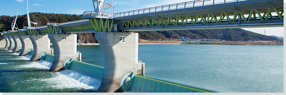
Water Resources Management
TOPTechnology allows for day-by-day tracking of extreme weather, alerting authorities to crop failures, monitoring inland water resources and tracing the steady spread of deserts and deforestation, water is central to all aspects of human life.
GEO will advocate the value of Earth observations, engage communities and deliver data and information in support of Water Resources Management by supporting management of water resources, including the cryosphere, while fostering and maintaining water quality; in order to ensure the availability and sustainable management of water and sanitation through sound science-based public policies informed by Earth observations, modelling and data integration.
About Water
TOP-
Freshwater is vital for households, agriculture, and industry, and ever larger quantities will be needed for burgeoning human populations over the coming decades. Unfortunately, current observation systems cannot adequately monitor long-term changes and transfers in the global water system and their implications for people, the climate, and biodiversity.
-
The amount of freshwater available for human consumption and for ecosystem services is affected by many variables. The Global Earth Observation System of Systems seeks to track these variables by filling in existing information gaps about water resources, integrating data sets from various monitoring systems, developing better forecasting models, and disseminating the results to a wider range of decision makers.
-
A key next step for the GEOSS will be to combine water-level data from satellite-based radar altimeters with data from ground-level, in-situ monitors. This will improve the ability of water managers to map the water cycles of major rivers.
-
The Group on Earth Observations is also standardizing metadata and improving the accuracy of data and predictions. It aims to establish global prediction models and then develop national-level models and finally river-basin or catchment-level models. These models will eventually become interoperable, creating a “system of systems” that will facilitate the global exchange of observation data and forecasting information.

-
Ministry of Science and ICT, Government Complex-Gwacheon, 47, Gwanmun-ro, Gwacheon-si, Gyeonggi-do 13809, KOREA
TEL: 02-2181-0396
Copyright © 2018 KGEO. ALL Rights Reserved.